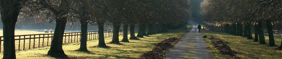
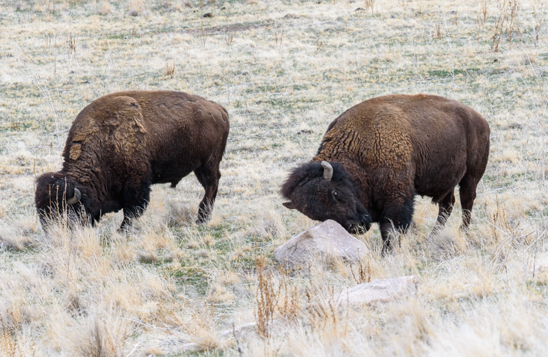
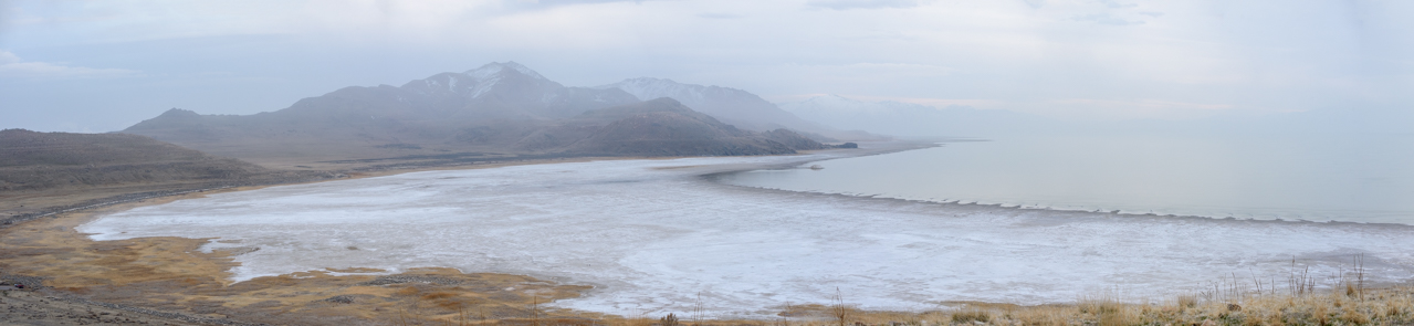
 After months of lockdown, I managed to get out of town and spend a few days with Dima from UTadventure doing a nature and landscape photography tour. The first afternoon after my arrival we went to Antelope Island on the Great Salt Lake and managed to find some wild animals including several large herds of buffalo. At sunset, we also caught some hazy moody shorelines that seemed more reminiscent of the Northern California coast.
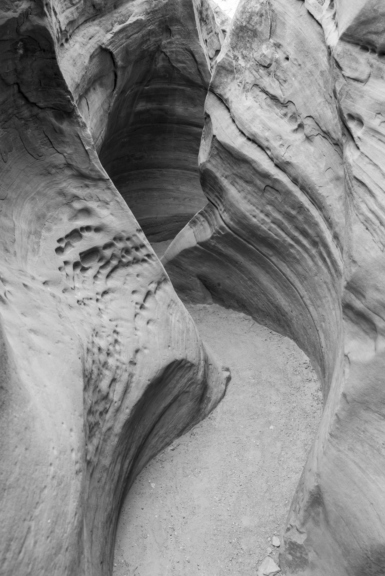 The next morning we headed down south and spent the remainder of the tour exploring a multitude of sites in the San Rafael Swell and Moab areas. After driving down, we went into the San Rafael Swell to explore and photograph Little Wildhorse Canyon. This is another beautiful slot canyon, in the same general vicinity as Crack Canyon where we’ve shot a couple of times with models, but much narrower with tighter meanders. It was quite beautiful and required some scrambling up some rocks to climb through. The only downside was that even though this was midweek in March, there seemed to be a lot of families with kids hiking through (including one very large family group). Some of the tight areas could feel a bit claustrophobic with gangs of kids coming up loudly behind you pressing you along faster than you might otherwise want to travel. Nonetheless, we got in a good hike and I was able to take some interesting pictures. After that we drove out to Molly’s Castle overlook for some nice scenery, then headed down into Goblin Valley State Park to check out the Valley of the Goblins near sunset. We had driven past signs to the entrance a number of times on previous tours but had never gone in, so I was pretty happy about this. It was very surreal and cool.
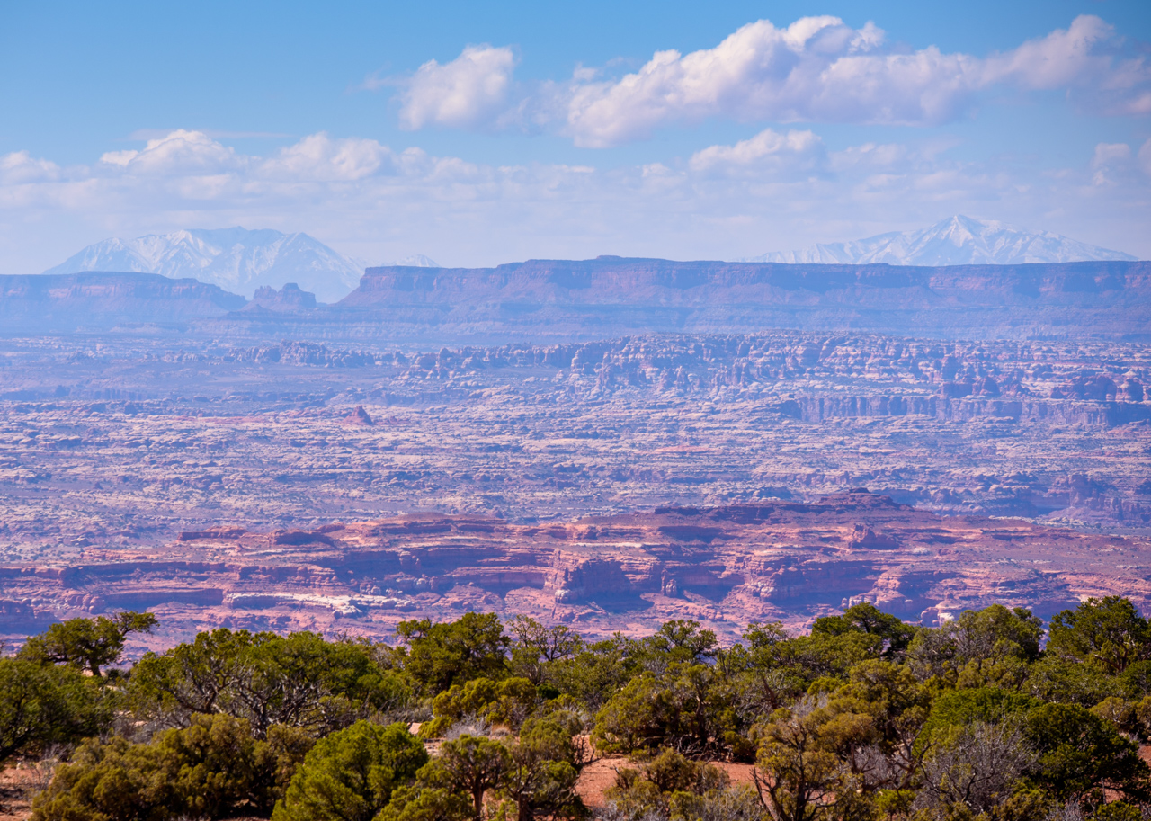 The next day we headed down towards the Moab area for what turned out to be a wide-ranging scenic tour. We took the road traveling along the Colorado River and were hoping to see some bald eagles. It was a bit windy and we never did see any, but we saw the spectacular landscapes. Coming in we had a nice view of Fisher Towers and the monoliths from Professor Valley where I’ve shot before. We explored up one of the side roads that took us above and behind them for a different view. Passing Moab we sent south on Highway 191, driving by Wilson’s Arch, an interesting sandstone arch right off the highway, and then headed out west into the desert. We ended up at Needles Overlook, which sits at the edge of a large plateau overlooking a vast valley that contains Canyonlands National Park. The overlook was part of a nicely maintained little park that had an interesting path going around the curve of one outcropping of the plateau. The panorama was amazing. After spending some time there for photography, we headed back into Moab for a late lunch.
After lunch, we headed a bit off-road again to the north, stopping at a place that allowed us to walk into the backside of Arches National Park for a little distance. We were able to get some interesting shots of the sandstone columns. After that, we headed back to Green River and actually headed into Green River State Park hoping to either get some nice sunsets or even some wildlife. We kept missed any spectacular sunsets, but as it got dark we got a brief glimpse of a bighorn sheep. We stopped and waited in the dark, and we could hear them moving around back in the trees along the river, but they never revealed themselves. Eventually, we headed back into town and went to bed.
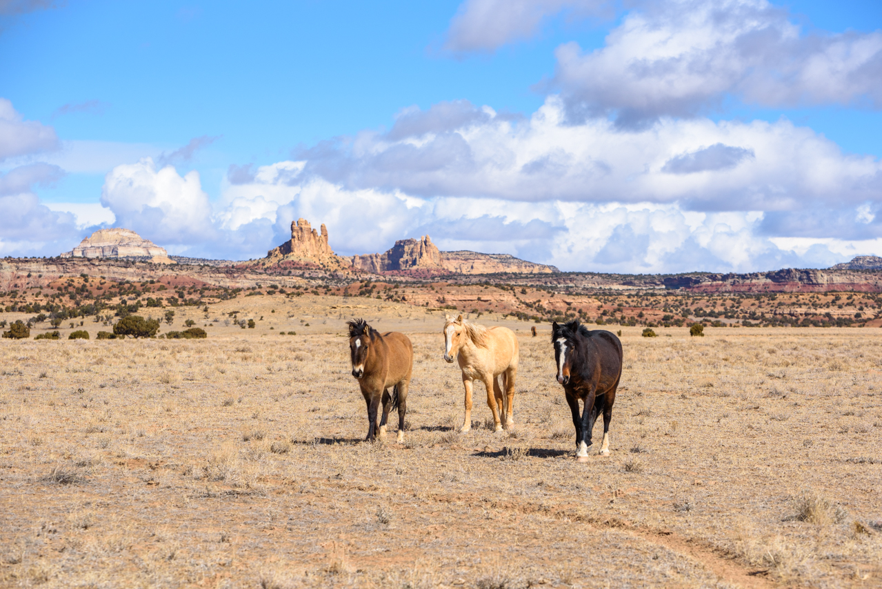 The last day began with an epic sightseeing tour around the San Rafael Swell. A primary goal was to see if we could find some wild horses. Along the way, we managed to see a couple of groups of pronghorn antelope. We started in on some moderate 4-wheeling paths and came to Swasey’s Cabin. After a little looking around, we then headed out onto McKay Flat. There we spotted a small family group of mustangs. We stopped and tried getting some shots, but they spotted us and headed off across the plains. We decided to drive past where they were going and stop and head out onto the plain ahead of them. Eventually, they got comfortable enough with us to get closer to us. Dima had an apple and was trying to coax them in, but they came within 6 or 8 feet but then moseyed off. It was very cool to see them, and I got some nice shots with the epic landscape in the background. Afterward, we drove around the Swell some more going to Hondu Arch and up Reds Canyon, even passing an old Uranium mine. We eventually got back to a paved road at the point where we usually take a rest break on the way to Crack Canyon. It was an amazing landscape tour, with the added bonus of seeing the mustangs and some pronghorn antelope.
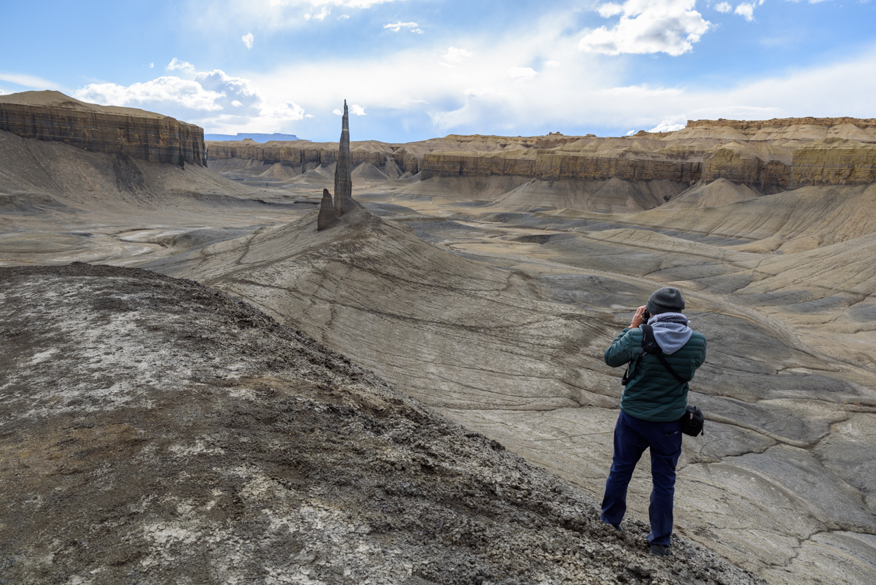 After getting lunch in Hanksville we headed toward one last feature Dima wanted to show me, something he called the spire, but which seems to be known more as Long Dong Silver. It is a rock tower located near the badlands, a desert area with very gray rock and sand, distinct from the other red and yellow desert features we had seen during the trip. This tower is a sharp shale spire jutting out of the sandy gray surroundings and has a very Mordor/Isengard-like feel. It was a bit of a hike to get out there, almost 2 miles, which was only a challenge due to my lack of sleep and a bit of car sickness. Nevertheless, we made it out, Dima urging me up the final hill, and we got some nice shots. We also met a young guy who had also trekked out to see it (who was much more energetic than me). After hiking back, we headed back for a final drive to Salt Lake City, stopping along the way for a nice relaxed dinner.